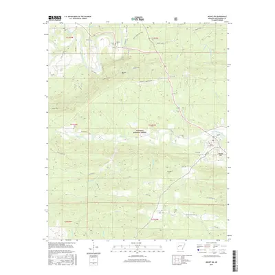
2017 Map of Mount Ida
USGS Topo · Published 2017About this map
Mount Ida serves as the primary hub in this Montgomery County landscape, situated where the South Fork Ouachita River meets the local road network. The surrounding terrain is defined by the high ridges of the Ouachita National Forest, including the prominent Mauldin Mtn north of the river. This 2017 survey reveals a community deeply connected to its ancestry through numerous small burial grounds dispersed across the forest and river bottoms, such as Old Salyer Cem, Garrett Cem, and Amason Cem. These sites, often located near old homestead roads like Goss Rd and Alexander Rd, offer valuable touchpoints for genealogists. The map also traces the Womble Trail S, a long-distance path that follows the topography of the Ouachitas, illustrating the area's continued reliance on the forest for both recreation and geography.
Find a feature on this map
60 named features on this map. Tap any name to fly to it.
Don’t see what you’re looking for? This feature index may not catch every label — zoom into the map to look around manually.
Map Details
Editions of this 2017 Mount Ida Map
This is the sole edition of this map. No revisions or reprints were ever made.
Other maps of this area

1890 · Mount Ida
USGS Topo · 1:125,000

1906 · Caddo Gap
USGS Topo · 1:125,000

1936 · Athens
USGS Topo · 1:48,000

1936 · Glenwood
USGS Topo · 1:48,000

1942 · Glenwood
USGS Topo · 1:62,500

1942 · Athens
USGS Topo · 1:62,500

1949 · Glenwood
USGS Topo · 1:62,500

1955 · Little Rock
USGS Topo · 1:250,000

1956 · Little Rock
USGS Topo · 1:250,000

1959 · Oden
USGS Topo · 1:62,500