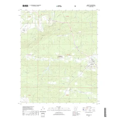
2020 Map of Mount Ida
USGS Topo · Published 2020About this map
The Montgomery County Courthouse serves as the focal point for the settlement of Mount Ida, located at the confluence of local routes like Golden Rd and Luzerne St. This 2020 survey documents the complex topography of the Ouachita National Forest, where the Ouachita River and the South Fork Ouachita River wind through the hills. To the northwest, the small settlement of Hog Jaw sits near Mauldin Mtn, illustrating the dispersed residential patterns typical of this portion of the Ouachita Mountains. The map is a significant resource for genealogists, detailing numerous family and community burial sites such as Mullenix Cem, Amerson Cem, and the Old Salyer Cem. These landmarks, along with many named creeks like Big Cedar Creek and Crump Cr, provide a framework for understanding the historical land use and family lineages of central Montgomery County.
Find a feature on this map
67 named features on this map. Tap any name to fly to it.
Don’t see what you’re looking for? This feature index may not catch every label — zoom into the map to look around manually.
Map Details
Editions of this 2020 Mount Ida Map
This is the sole edition of this map. No revisions or reprints were ever made.
Other maps of this area

1890 · Mount Ida
USGS Topo · 1:125,000

1906 · Caddo Gap
USGS Topo · 1:125,000

1936 · Athens
USGS Topo · 1:48,000

1936 · Glenwood
USGS Topo · 1:48,000

1942 · Glenwood
USGS Topo · 1:62,500

1942 · Athens
USGS Topo · 1:62,500

1949 · Glenwood
USGS Topo · 1:62,500

1955 · Little Rock
USGS Topo · 1:250,000

1956 · Little Rock
USGS Topo · 1:250,000

1959 · Oden
USGS Topo · 1:62,500