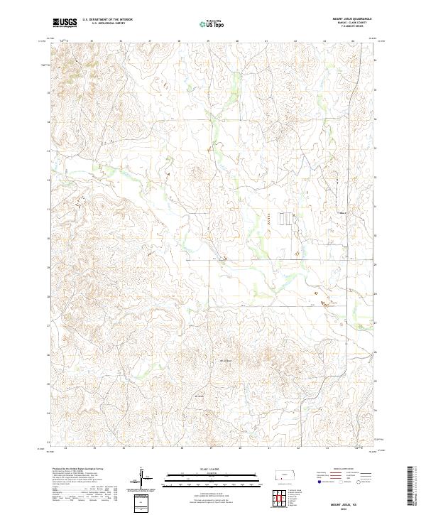
2022 Map of Mount Jesus
USGS Topo · Published 2022About this map
Mt Jesus and Mt Lookout define the high points of this western Kansas landscape, providing a clear view of the complex drainage systems that carve through Clark County. The terrain is characterized by the confluence of several vital watercourses, including the prominent Bluff Cr and its tributaries such as Fish Cr and Hackberry Cr. These streams create a network of draws and valleys that have long shaped the ranching and agricultural potential of the region.
Find a feature on this map
18 named features on this map. Tap any name to fly to it.
Don’t see what you’re looking for? This feature index may not catch every label — zoom into the map to look around manually.
Map Details
Editions of this 2022 Mount Jesus Map
This is the sole edition of this map. No revisions or reprints were ever made.
Other maps of this area

1894 · Sitka
USGS Topo · 1:62,500

1896 · Ashland
USGS Topo · 1:125,000

1955 · Pratt
USGS Topo · 1:250,000

1959 · Pratt
USGS Topo · 1:250,000
1972 · Ashland
USGS Topo · 1:24,000

1979 · Sitka
USGS Topo · 1:24,000

1979 · Bloom SE
USGS Topo · 1:24,000

1979 · Sugarloaf
USGS Topo · 1:24,000

1979 · Turkey Creek
USGS Topo · 1:24,000
1979 · Simmons Creek
USGS Topo · 1:24,000