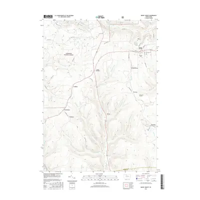
2016 Map of Mount Jewett
USGS Topo · Published 2016About this map
Allegheny National Forest dominates the western portion of this McKean County landscape, where the rugged topography is carved by the headwaters of the W Br Clarion River and Kinzua Creek. The borough of Mount Jewett serves as a primary hub of settlement, positioned near the high ground of Howard Hill. This 2016 survey illustrates a community deeply tied to its geography, with smaller hamlets like Lantz Corners and Kanesholm following the ridge lines and valley floors. Local history and genealogy interest is anchored by the Bridge View Cem and the distinctive elevations of Seven Mile Summit. The map details a complex network of forest routes, including Mead Run Rd and Forest Rd 150, which reflect the area's ongoing relationship with timber and natural resource management in the Pennsylvania highlands.
Find a feature on this map
60 named features on this map. Tap any name to fly to it.
Don’t see what you’re looking for? This feature index may not catch every label — zoom into the map to look around manually.
Map Details
Editions of this 2016 Mount Jewett Map
This is the sole edition of this map. No revisions or reprints were ever made.
Other maps of this area

1924 · Bradford
USGS Topo · 1:62,500

1926 · Bradford
USGS Topo · 1:62,500

1934 · Kane
USGS Topo · 1:48,000

1935 · Mt. Jewett
USGS Topo · 1:48,000

1936 · Kinzua
USGS Topo · 1:48,000

1939 · Kane
USGS Topo · 1:62,500

1940 · Mt. Jewett
USGS Topo · 1:62,500

1941 · Kinzua
USGS Topo · 1:62,500

1941 · Bradford
USGS Topo · 1:62,500

1944 · Bradford
USGS Topo · 1:62,500
Featured Places
- Mount Jewett, PA
- Campbelltown, Hamlin Township
- Griffiths, Hamlin Township
- Cartwrights Crossing, Wetmore Township
- Jones Township, PA