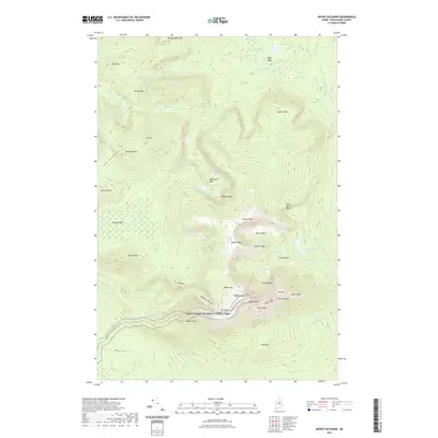
2021 Map of Mount Katahdin
USGS Topo · Published 2021About this map
Mt Katahdin dominates this high-altitude landscape, where the Appalachian National Scenic Trail winds its way toward its northern terminus. The map provides an intricate look at the massif's jagged geography, from the sharp arête of Knife Edge to the high points of Baxter Peak and South Peak. Glacial activity is evident in the deeply carved depressions of the North Basin, South Basin, and the Northwest Basin, many of which hold alpine waters like Chimney Pond and Lake Cowles.
Find a feature on this map
62 named features on this map. Tap any name to fly to it.
Don’t see what you’re looking for? This feature index may not catch every label — zoom into the map to look around manually.
Map Details
Editions of this 2021 Mount Katahdin Map
This is the sole edition of this map. No revisions or reprints were ever made.
Other maps of this area

1927 · Katahdin
USGS Topo · 1:48,000

1930 · Katahdin
USGS Topo · 1:62,500

1949 · Katahdin
USGS Topo · 1:62,500

1953 · Telos Lake
USGS Topo · 1:62,500

1954 · Harrington Lake
USGS Topo · 1:62,500

1954 · Presque Isle
USGS Topo · 1:250,000

1954 · Millinocket
USGS Topo · 1:250,000

1955 · Traveler Mountain
USGS Topo · 1:62,500

1957 · Telos Lake
USGS Topo · 1:62,500

1958 · Presque Isle
USGS Topo · 1:250,000