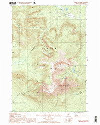
1997 Map of Mount Katahdin
USGS Topo · Published 1999About this map
Baxter State Park encompasses a dramatic glacial landscape centered on the massive granite massif of Mount Katahdin. This 1990s survey, updated from 1982 imagery, illustrates the vertical scale of the Maine wilderness, from the depths of Witherle Ravine to the iconic Knife Edge ridge connecting Baxter Peak and Pamola. The map traces the northern terminus of the National Scenic Trail as it ascends past Katahdin Stream Falls toward the alpine Table Land.
Find a feature on this map
66 named features on this map. Tap any name to fly to it.
Don’t see what you’re looking for? This feature index may not catch every label — zoom into the map to look around manually.
Map Details
Editions of this 1997 Mount Katahdin Map
This is the sole edition of this map. No revisions or reprints were ever made.
Other maps of this area

1927 · Katahdin
USGS Topo · 1:48,000

1930 · Katahdin
USGS Topo · 1:62,500

1949 · Katahdin
USGS Topo · 1:62,500

1953 · Telos Lake
USGS Topo · 1:62,500

1954 · Harrington Lake
USGS Topo · 1:62,500

1954 · Presque Isle
USGS Topo · 1:250,000

1954 · Millinocket
USGS Topo · 1:250,000

1955 · Traveler Mountain
USGS Topo · 1:62,500

1957 · Telos Lake
USGS Topo · 1:62,500

1958 · Presque Isle
USGS Topo · 1:250,000