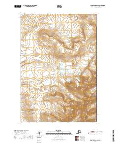
2019 Map of Mount Katmai B-6 SW
USGS Topo · Published 2019About this map
Katmai National Park encompasses the entirety of this interior landscape, documented by the U.S. Geological Survey in 2019. This survey is defined by its dramatic topographic relief, featuring unnamed peaks and ridges that rise over 3,000 feet. The terrain is structured by the Public Land Survey System boundaries of T21s R41w, T21s R40w, T22s R41w, and T22s R40w. This specific quadrangle captures a section of the Alaska Peninsula where drainage systems and high-altitude contours dominate the visual record, devoid of any named human settlements or road infrastructure. The map provides a precise look at the raw physical geography of this protected wilderness area as it appeared in the early 21st century.
Find a feature on this map
5 named features on this map. Tap any name to fly to it.
Don’t see what you’re looking for? This feature index may not catch every label — zoom into the map to look around manually.
Map Details
Editions of this 2019 Mount Katmai B-6 SW Map
This is the sole edition of this map. No revisions or reprints were ever made.
Other maps of this area

1948 · Mt Katmai
USGS Topo · 1:250,000

1951 · Mt Katmai
USGS Topo · 1:250,000

1951 · Mount Katmai A-6
USGS Topo · 1:63,360

1951 · Mount Katmai B-6
USGS Topo · 1:63,360

1951 · Naknek B-1
USGS Topo · 1:63,360

1951 · Naknek A-1
USGS Topo · 1:63,360

1952 · Naknek
USGS Topo · 1:250,000
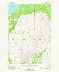
1953 · Mt. Katmai B-6
USGS Topo · 1:63,360

1964 · Mt. Katmai
USGS Topo · 1:250,000

1964 · Naknek
USGS Topo · 1:250,000