
1951 Map of Naknek A-1
USGS Topo · Published 1956About this map
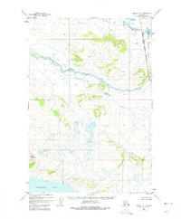
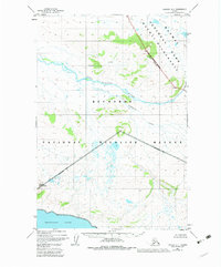
Becharof Lake defines the southern landscape of this 1950s survey, marking a transition from the vast waters of the Alaska Peninsula to the interior highlands. The King Salmon River snakes through the center of the sheet, fed by the waters of Granite Creek and Gertrude Creek. This region, mapped primarily through aerial photography in the early post-war era, remains largely untouched by development, with the exception of a lone Cabin identified on the northern shore of the lake. To the east, the Katmai National Monument Boundary marks the edge of federally protected wilderness, established decades earlier to preserve the volcanic and coastal ecosystems. The map provides a detailed record of the drainage patterns and topographic contours of this subarctic environment before modern infrastructure altered the more accessible reaches of the peninsula.
Find a feature on this map
8 named features on this map. Tap any name to fly to it.
Don’t see what you’re looking for? This feature index may not catch every label — zoom into the map to look around manually.
Map Details
Editions of this 1951 Naknek A-1 Map
3 editions found
Other maps of this area

1943 · Ugashik
USGS Topo · 1:250,000

1948 · Mt Katmai
USGS Topo · 1:250,000

1948 · Ugashik
USGS Topo · 1:250,000

1949 · Ugashik
USGS Topo · 1:250,000

1951 · Mt Katmai
USGS Topo · 1:250,000

1951 · Karluk
USGS Topo · 1:250,000

1951 · Mount Katmai A-6
USGS Topo · 1:63,360

1951 · Ugashik D-1
USGS Topo · 1:63,360

1951 · Mount Katmai B-6
USGS Topo · 1:63,360

1951 · Naknek B-1
USGS Topo · 1:63,360