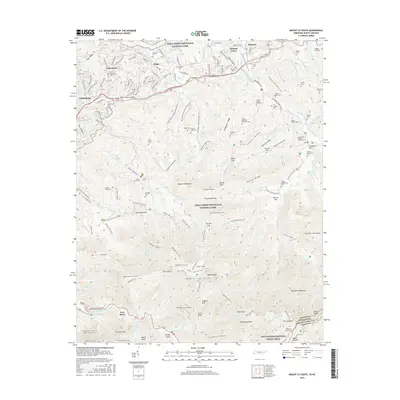
2016 Map of Mount Le Conte
USGS Topo · Published 2016About this map
Mount Le Conte dominates this survey of the high peaks within Great Smoky Mountains National Park, where elevations rise sharply from the valley floors of Gatlinburg and Pittman Center. The landscape is a network of ridges and watercourses, including the West Prong Little Pigeon River and Roaring Fork, that have long defined the settlement patterns of this region. Near the southern boundary, the Appalachian National Scenic Trail traverses the crest along Anakeesta Ridge and Mount Kephart.
Find a feature on this map
140 named features on this map. Tap any name to fly to it.
Don’t see what you’re looking for? This feature index may not catch every label — zoom into the map to look around manually.
Map Details
Editions of this 2016 Mount Le Conte Map
This is the sole edition of this map. No revisions or reprints were ever made.
Other maps of this area

1886 · Knoxville
USGS Topo · 1:125,000

1892 · Knoxville
USGS Topo · 1:125,000

1893 · Mt Guyot
USGS Topo · 1:125,000

1894 · Knoxville
USGS Topo · 1:125,000

1895 · Knoxville
USGS Topo · 1:125,000

1901 · Knoxville
USGS Topo · 1:125,000

1912 · Mt Guyot
USGS Topo · 1:125,000

1935 · English Mountain
USGS Topo · 1:48,000

1935 · Jones Cove
USGS Topo · 1:24,000

1935 · Richardson Cove
USGS Topo · 1:24,000