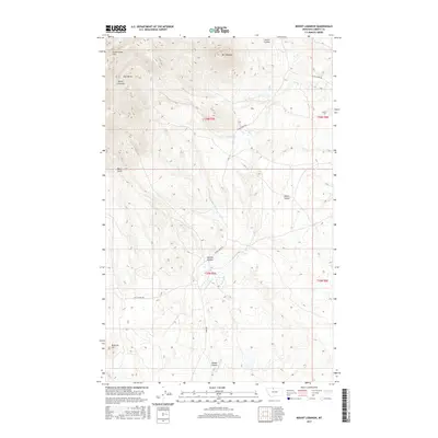
2017 Map of Mount Lebanon
USGS Topo · Published 2017About this map
The Sweet Grass Hills dominate this section of Liberty County, Montana, punctuated by the high elevations of Mt Lebanon and East Butte. This area of the northern high plains is defined by its dramatic geologic formations, including landmarks such as the Devils Chimney and the Bear Tooth. The landscape is etched by a series of distinct drainages and coulees, including McTosh Coulee, Snoose Coulee, and Scotch Coulee, which channel water toward creeks like Tootsie Cr and Government Cr.
Find a feature on this map
23 named features on this map. Tap any name to fly to it.
Don’t see what you’re looking for? This feature index may not catch every label — zoom into the map to look around manually.
Map Details
Editions of this 2017 Mount Lebanon Map
This is the sole edition of this map. No revisions or reprints were ever made.
Other maps of this area

1919 · Alma
USGS Topo · 1:125,000

1954 · Shelby
USGS Topo · 1:250,000

1958 · Shelby
USGS Topo · 1:250,000
1962 · Bingham Lake
USGS Topo · 1:24,000

1962 · Lakey Ranch
USGS Topo · 1:24,000

1962 · Blair Ranch
USGS Topo · 1:24,000
1962 · Hawley Hill
USGS Topo · 1:24,000

1962 · Haystack Butte
USGS Topo · 1:24,000

1962 · Mount Lebanon
USGS Topo · 1:24,000

1963 · Vaver Reservoir
USGS Topo · 1:24,000