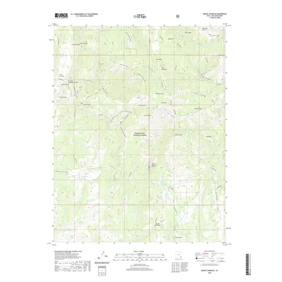
2020 Map of Mount Linnaeus
USGS Topo · Published 2020About this map
Mt Linnaeus towers over this section of the Abajo Mountains within the Manti-La Sal National Forest, where the high-altitude landscape is defined by a series of dramatic ridges and deep drainages. The complex topography is marked by named summits such as Bob Park Peak, West Mtn, and the evocatively named Skull and Crossbones Summit. The area reveals a history of seasonal grazing and water management, evidenced by high-country clearings like Robertson Pasture, Aspen Flat, and Cliff Dwellers Pasture, alongside essential water sources such as Blue Cr Reservoir and Dry Wash Reservoir. Access into these canyons and onto the ridges is facilitated by a network of established paths, including the Trough Canyon Trail (163) and Chippean Canyon Trail (452). The map provides a detailed view of the drainage systems that carve the terrain, from Blue Creek-Allen Canyon to the headwaters of Indian Cr.
Find a feature on this map
39 named features on this map. Tap any name to fly to it.
Don’t see what you’re looking for? This feature index may not catch every label — zoom into the map to look around manually.
Map Details
Editions of this 2020 Mount Linnaeus Map
This is the sole edition of this map. No revisions or reprints were ever made.
Other maps of this area

1886 · Abajo
USGS Topo · 1:250,000

1892 · Abajo
USGS Topo · 1:250,000

1893 · Abajo
USGS Topo · 1:250,000

1935 · Elk Ridge
USGS Topo · 1:96,000

1940 · Elk Ridge
USGS Topo · 1:125,000

1954 · Elk Ridge 4 NW
USGS Topo · 1:24,000

1954 · Elk Ridge 1 SW
USGS Topo · 1:24,000

1954 · Elk Ridge 1 NW
USGS Topo · 1:24,000

1954 · Elk Ridge 1 NE
USGS Topo · 1:24,000

1954 · Elk Ridge 1 SE
USGS Topo · 1:24,000