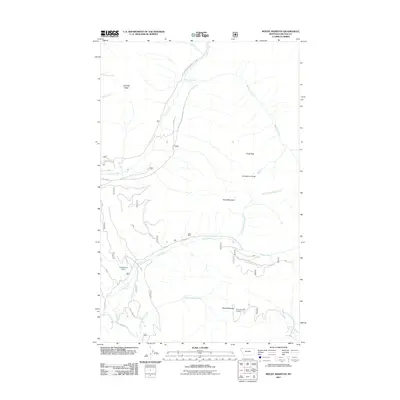
2011 Map of Mount Marston
USGS Topo · Published 2011About this map
Mount Marston and its high-elevation Mount Marston Lookout anchor this survey of the northern Whitefish Range. The landscape is defined by deep drainage basins and significant ridge lines, including Gibralter Ridge and the sharp summits of Krag Peak and Krinklehorn Peak. The map documents early 21st-century land management and resource use in Lincoln County, highlighting the Jager Mine and the Vredenburg Dam located along the upper reaches of Deep Creek. A complex network of Forest Service infrastructure, such as Natl Forest Develop Road 114 Rd and Grave Cr Rd, provides access through the drainage systems of Grave Creek and Laughing Water Creek. These routes follow the natural contours of the terrain, illustrating the modern intersection of industrial history and forest service stewardship in the Montana backcountry.
Find a feature on this map
24 named features on this map. Tap any name to fly to it.
Don’t see what you’re looking for? This feature index may not catch every label — zoom into the map to look around manually.
Map Details
Editions of this 2011 Mount Marston Map
This is the sole edition of this map. No revisions or reprints were ever made.
Other maps of this area

1913 · Stryker
USGS Topo · 1:125,000

1916 · Stryker
USGS Topo · 1:125,000

1957 · Kalispell
USGS Topo · 1:250,000

1960 · Kalispell
USGS Topo · 1:250,000

1961 · Kalispell
USGS Topo · 1:250,000

1963 · Mount Marston
USGS Topo · 1:24,000

1963 · Ksanka Peak
USGS Topo · 1:24,000

1963 · Stryker
USGS Topo · 1:24,000

1963 · Stahl Peak
USGS Topo · 1:24,000
1963 · Edna Mountain
USGS Topo · 1:24,000