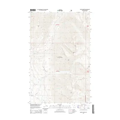
2014 Map of Mount Marston
USGS Topo · Published 2014About this map
Fortine occupies a small clearing in the southwest corner of this mountain-dominated landscape within the Kootenai National Forest. The terrain is defined by high ridgelines and prominent summits, including Mt Marston and Krinklehorn Peak, which rise above a network of drainages such as Grave Creek and Laughing Water Creek. These waterways carve deep V-shaped valleys through the timbered slopes, creating a complex series of benches and spurs. This 2014 survey documents the established forest road network, featuring routes like Stoken Rd and Jeager Rd, which provide access through the interior. Local family-named landmarks and peaks like Mt Petery and Gibralter Ridge highlight the intersection of natural topography and local identity in this part of Lincoln County.
Find a feature on this map
39 named features on this map. Tap any name to fly to it.
Don’t see what you’re looking for? This feature index may not catch every label — zoom into the map to look around manually.
Map Details
Editions of this 2014 Mount Marston Map
This is the sole edition of this map. No revisions or reprints were ever made.
Other maps of this area

1913 · Stryker
USGS Topo · 1:125,000

1916 · Stryker
USGS Topo · 1:125,000

1957 · Kalispell
USGS Topo · 1:250,000

1960 · Kalispell
USGS Topo · 1:250,000

1961 · Kalispell
USGS Topo · 1:250,000

1963 · Mount Marston
USGS Topo · 1:24,000

1963 · Ksanka Peak
USGS Topo · 1:24,000

1963 · Stryker
USGS Topo · 1:24,000

1963 · Stahl Peak
USGS Topo · 1:24,000
1963 · Edna Mountain
USGS Topo · 1:24,000