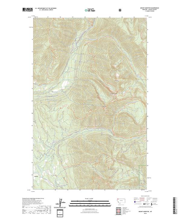
2024 Map of Mount Marston
USGS Topo · Published 2024About this map
Fortine sits at the southwestern edge of a landscape defined by the high elevations of the Whitefish Range and the Kootenai National Forest. This 2024 survey detail reveals a complex network of seasonal access and recreational routes, including the Deep Creek X-C Ski Trl and the Grave Creek Snowmobile Trl, which navigate the steep drainage systems of Grave Creek and Deep Creek. The topography is marked by prominent summits such as Mt Marston, Krinklehorn Peak, and Krag Peak, while Gibraltar Ridge dominates the northwestern terrain.
Find a feature on this map
54 named features on this map. Tap any name to fly to it.
Don’t see what you’re looking for? This feature index may not catch every label — zoom into the map to look around manually.
Map Details
Editions of this 2024 Mount Marston Map
This is the sole edition of this map. No revisions or reprints were ever made.
Other maps of this area

1913 · Stryker
USGS Topo · 1:125,000

1916 · Stryker
USGS Topo · 1:125,000

1957 · Kalispell
USGS Topo · 1:250,000

1960 · Kalispell
USGS Topo · 1:250,000

1961 · Kalispell
USGS Topo · 1:250,000

1963 · Mount Marston
USGS Topo · 1:24,000

1963 · Ksanka Peak
USGS Topo · 1:24,000

1963 · Stryker
USGS Topo · 1:24,000

1963 · Stahl Peak
USGS Topo · 1:24,000
1963 · Edna Mountain
USGS Topo · 1:24,000