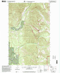
1997 Map of Mount Marston
USGS Topo · Published 2000About this map
Kootenai National Forest and the Stillwater State Forest dominate this Lincoln County landscape, centered on the high peaks of the Whitefish Range during the late twentieth century. Elevation data from Mount Marston and surrounding summits like Krinklehorn Peak and Krag Peak reveal a steep environment managed for timber and resources. The map highlights localized extractive industries, including the Schmitz Mine and Jager Mine, alongside evidence of recreational development such as a Golf Course and a Gaging Station on Grave Creek.
Find a feature on this map
18 named features on this map. Tap any name to fly to it.
Don’t see what you’re looking for? This feature index may not catch every label — zoom into the map to look around manually.
Map Details
Editions of this 1997 Mount Marston Map
This is the sole edition of this map. No revisions or reprints were ever made.
Other maps of this area

1913 · Stryker
USGS Topo · 1:125,000

1916 · Stryker
USGS Topo · 1:125,000

1957 · Kalispell
USGS Topo · 1:250,000

1960 · Kalispell
USGS Topo · 1:250,000

1961 · Kalispell
USGS Topo · 1:250,000

1963 · Mount Marston
USGS Topo · 1:24,000

1963 · Ksanka Peak
USGS Topo · 1:24,000

1963 · Stryker
USGS Topo · 1:24,000

1963 · Stahl Peak
USGS Topo · 1:24,000
1963 · Edna Mountain
USGS Topo · 1:24,000