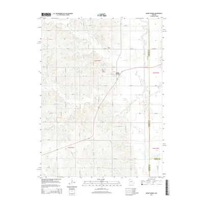
2015 Map of Mount Moriah
USGS Topo · Published 2015About this map
Mount Moriah sits at the intersection of local routes in Harrison County, serving as the primary hub for a landscape defined by small-scale agriculture and managed water resources. The terrain is crisscrossed by a network of creeks including Panther Cr, Trail Cr, and Cat Cr, which feed into the Thompson River along the eastern boundary. This 2015 survey reveals a high density of private and county-managed water bodies, such as Hamilton Lake, Harrison County Lake E-1, and G Pitts Lake, illustrating the region's reliance on these basins for drainage and local use. Genealogists will find two significant burial sites documented: Stoner Cemetery to the north and the larger Mount Moriah Cemetery located just west of the main settlement. The map also captures the precise boundaries where Harrison, Mercer, and Grundy counties meet, providing a clear record of administrative lines and rural road naming conventions in this portion of Missouri.
Find a feature on this map
49 named features on this map. Tap any name to fly to it.
Don’t see what you’re looking for? This feature index may not catch every label — zoom into the map to look around manually.
Map Details
Editions of this 2015 Mount Moriah Map
This is the sole edition of this map. No revisions or reprints were ever made.
Other maps of this area

1925 · Gilman
USGS Topo · 1:62,500

1946 · Gilman
USGS Topo · 1:48,000

1946 · Princeton
USGS Topo · 1:62,500

1947 · Blythedale
USGS Topo · 1:62,500

1948 · Gilman
USGS Topo · 1:62,500

1948 · Princeton
USGS Topo · 1:62,500

1948 · Trenton
USGS Topo · 1:62,500

1954 · Centerville
USGS Topo · 1:250,000

1957 · Centerville
USGS Topo · 1:250,000

1958 · Centerville
USGS Topo · 1:250,000