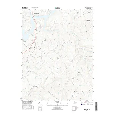
2016 Map of Mount Nebo
USGS Topo · Published 2016About this map
Summersville Lake and the Gauley River dominate the northern landscape of Nicholas County, where high ridges and deep drainages define the settlement patterns. This 2016 survey illustrates a region where life follows the high ground of Bryant Ridge and Jims Ridge, with the modern footprint of Summersville Airport contrasted against a network of much older rural roads. For family historians, the sheet is exceptionally detailed in its documentation of community burial grounds, recording sites such as Fowlers Knob Cem, Gilgal Cem, and Hickory Grove Cem. Small, scattered communities like Mount Nebo, Pool, and Runa are connected by a web of routes including Old Nicholas Rd and Old Gauley Rd, reflecting the long-standing transportation corridors that carved through this dissected plateau long before the impoundment of the lake.
Find a feature on this map
102 named features on this map. Tap any name to fly to it.
Don’t see what you’re looking for? This feature index may not catch every label — zoom into the map to look around manually.
Map Details
Editions of this 2016 Mount Nebo Map
This is the sole edition of this map. No revisions or reprints were ever made.
Other maps of this area

1889 · Nicholas
USGS Topo · 1:125,000

1891 · Nicholas
USGS Topo · 1:125,000

1901 · Nicholas
USGS Topo · 1:125,000

1913 · Summersville
USGS Topo · 1:48,000

1914 · Winona
USGS Topo · 1:48,000

1915 · Cowen
USGS Topo · 1:48,000
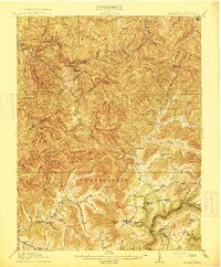
1915 · Summersville
USGS Topo · 1:62,500

1916 · Winona
USGS Topo · 1:62,500

1917 · Cowen
USGS Topo · 1:62,500

1918 · Richwood
USGS Topo · 1:62,500