
1913 Map of Summersville
USGS Topo · Published 1913About this map
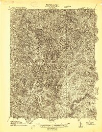
Summersville and its surrounding central West Virginia hamlets are mapped here during a period of agricultural and industrial transition before the construction of major modern reservoirs. The Gauley River carves through the southern portion of the quadrangle, serving as a primary drainage for a landscape dotted with family-named schools and small community churches. Educational hubs such as Eberly School, Fockler School, and Ramsey School indicate a dispersed but established rural population. The northern sections near Widen and Dille PO show the rugged geography of the Buffalo and Hamilton districts, where creek-side settlements like Hookersville and Enoch were linked by early roads and bridges, including Brocks Bridge. For genealogists, the map is a primary source for locating vanished landmarks like the Winebrenner School or the Young Monument, providing a clear look at the Nicholas County interior before mid-century topographical changes.
Find a feature on this map
148 named features on this map. Tap any name to fly to it.
Don’t see what you’re looking for? This feature index may not catch every label — zoom into the map to look around manually.
Map Details
Editions of this 1913 Summersville Map
3 editions found
Other maps of this area

1889 · Nicholas
USGS Topo · 1:125,000

1891 · Nicholas
USGS Topo · 1:125,000

1893 · Sutton
USGS Topo · 1:125,000

1897 · Kanawha Falls
USGS Topo · 1:125,000

1900 · Kanawha Falls
USGS Topo · 1:125,000

1901 · Nicholas
USGS Topo · 1:125,000

1901 · Kanawha Falls
USGS Topo · 1:125,000

1906 · Otter
USGS Topo · 1:62,500

1907 · Otter
USGS Topo · 1:62,500

1908 · Clay
USGS Topo · 1:48,000