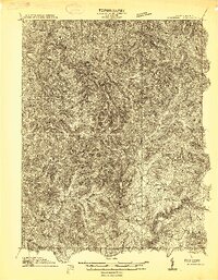
1913 Map of Summersville
USGS Topo · Published 1913About this map
Summersville and its surrounding hill country appear here as they were just before the first World War, surveyed by E. I. Ireland and C. S. Wells. The landscape is defined by the winding course of the Gauley River and the deep dissection of the Birch River to the north. Small settlements and post offices like Gad, Canvas, and Conrad are connected by a network of early roads and fords, including the notable Persinger Ford on Muddlety Creek.
Find a feature on this map
23 named features on this map. Tap any name to fly to it.
Don’t see what you’re looking for? This feature index may not catch every label — zoom into the map to look around manually.
Map Details
Editions of this 1913 Summersville Map
3 editions found

Other maps of this area

1889 · Nicholas
USGS Topo · 1:125,000

1891 · Nicholas
USGS Topo · 1:125,000

1893 · Sutton
USGS Topo · 1:125,000

1897 · Kanawha Falls
USGS Topo · 1:125,000

1900 · Kanawha Falls
USGS Topo · 1:125,000

1901 · Nicholas
USGS Topo · 1:125,000

1901 · Kanawha Falls
USGS Topo · 1:125,000

1906 · Otter
USGS Topo · 1:62,500

1907 · Otter
USGS Topo · 1:62,500

1908 · Clay
USGS Topo · 1:48,000