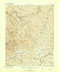
1913 Map of Summersville
USGS Topo · Published 1961About this map
The Summersville district in 1913 is defined by a dense network of mountain ridges and creek-bottom settlements during a period of burgeoning logging and extraction. In the north, the lumber-influenced communities of Widen and Swandale are connected by rugged topography, while the central hills feature landmarks like Youngs Monument on Powell Mountain. This era shows a landscape where rural education was highly localized, evidenced by the numerous small campus locations such as Armstrong School, Pecks School, and Winebrenner School. Crossing the Gauley River was a matter of specific geography, noted by the existence of Persinger Ford and Brocks Bridge. The map captures a moment when the county lines between Clay and Nicholas counties bisected a terrain of countless named forks and runs, reflecting a deeply ingrained local nomenclature for every valley.
Find a feature on this map
121 named features on this map. Tap any name to fly to it.
Don’t see what you’re looking for? This feature index may not catch every label — zoom into the map to look around manually.
Map Details
Editions of this 1913 Summersville Map
3 editions found

Other maps of this area

1889 · Nicholas
USGS Topo · 1:125,000

1891 · Nicholas
USGS Topo · 1:125,000

1893 · Sutton
USGS Topo · 1:125,000

1897 · Kanawha Falls
USGS Topo · 1:125,000

1900 · Kanawha Falls
USGS Topo · 1:125,000

1901 · Nicholas
USGS Topo · 1:125,000

1901 · Kanawha Falls
USGS Topo · 1:125,000

1906 · Otter
USGS Topo · 1:62,500

1907 · Otter
USGS Topo · 1:62,500

1908 · Clay
USGS Topo · 1:48,000