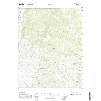
2020 Map of Mount Nebo
USGS Topo · Published 2020About this map
Riverside sits at the northwestern edge of this high-altitude landscape, where the Animas River flows near the base of the Mesa Mountains. This 2020 survey reveals a complex network of water management and natural hydrology, featuring irrigation works like the Twin Rock Ditch and Ralston Ditch alongside numerous natural springs such as Shovel Spring and Last Chance Spring. The terrain is defined by its dramatic erosion patterns, ranging from the prominent height of Mt Nebo to the deeply carved Ditch Canyon and Long Glade Canyon. Modern recreation and access are highlighted through the Allen Run Trail and the Allen Run Loop, which navigate the rugged topography south of the C C Reservoir. Landmark geologic formations including Arch Rock and the surrounding Arch Rock Canyon provide distinct navigational points for those studying the local geology or tracing backcountry routes in San Juan County.
Find a feature on this map
58 named features on this map. Tap any name to fly to it.
Don’t see what you’re looking for? This feature index may not catch every label — zoom into the map to look around manually.
Map Details
Editions of this 2020 Mount Nebo Map
This is the sole edition of this map. No revisions or reprints were ever made.
Other maps of this area

1889 · Largo
USGS Topo · 1:250,000

1895 · Largo
USGS Topo · 1:250,000

1908 · Ignacio
USGS Topo · 1:125,000

1924 · Ignacio
USGS Topo · 1:125,000

1945 · Durango
USGS Topo · 1:250,000

1953 · Durango
USGS Topo · 1:250,000

1954 · Durango
USGS Topo · 1:250,000

1954 · Aztec
USGS Topo · 1:250,000

1958 · Aztec
USGS Topo · 1:250,000

1959 · Aztec
USGS Topo · 1:62,500