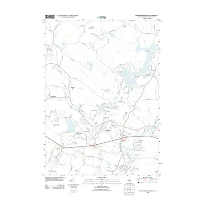
2012 Map of Mount Pawtuckaway
USGS Topo · Published 2012About this map
Pawtuckaway State Park dominates the northern landscape of this region, where the Pawtuckaway Mountains and peaks like Mount Pawtuckaway rise above a complex network of waterways. The Lamprey River and Pawtuckaway River thread through a topography marked by numerous small hills and ponds, including Onway Lake and Pawtuckaway Pond. This survey captures the town of Raymond as a central hub, surrounded by smaller residential clusters such as Pine Acres and Onway Lake VLG. Local heritage is anchored by sites like the Deerfield Fairgrounds and the Gove Cem, while the terrain is defined by named heights including Dumplingtown Hill and Rattlesnake Hill. The map illustrates a well-developed road network connecting these glacial landforms and settlements, reflecting a transition from the wooded heights of the north to the more settled valleys near the Exeter River in the south.
Find a feature on this map
159 named features on this map. Tap any name to fly to it.
Don’t see what you’re looking for? This feature index may not catch every label — zoom into the map to look around manually.
Map Details
Editions of this 2012 Mount Pawtuckaway Map
This is the sole edition of this map. No revisions or reprints were ever made.
Other maps of this area

1888 · Haverhill
USGS Topo · 1:62,500

1890 · Haverhill
USGS Topo · 1:62,500

1893 · Haverhill
USGS Topo · 1:62,500

1905 · Manchester
USGS Topo · 1:62,500

1917 · Mt. Pawtuckaway
USGS Topo · 1:62,500

1919 · Mt. Pawtuckaway
USGS Topo · 1:62,500

1921 · Suncook
USGS Topo · 1:62,500

1935 · Haverhill
USGS Topo · 1:62,500

1939 · Mt. Pawtuckaway
USGS Topo · 1:62,500

1941 · Manchester
USGS Topo · 1:62,500