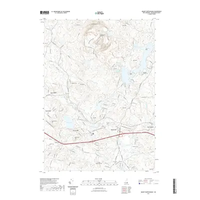
2021 Map of Mount Pawtuckaway
USGS Topo · Published 2021About this map
The Pawtuckaway Reservation dominates the northern landscape, where the jagged peaks of the Pawtuckaway Mountains rise above a complex network of trails, including the South Ridge Trl and Fire Tower Trl. This area is defined by the three distinct peaks of Mt Pawtuckaway, centered around the quiet waters of Round Pond. To the east, the geography shifts toward the massive reach of Fundy Cove and Mountain Cove, punctuated by Big Island and Horse Island.
Find a feature on this map
141 named features on this map. Tap any name to fly to it.
Don’t see what you’re looking for? This feature index may not catch every label — zoom into the map to look around manually.
Map Details
Editions of this 2021 Mount Pawtuckaway Map
This is the sole edition of this map. No revisions or reprints were ever made.
Other maps of this area

1888 · Haverhill
USGS Topo · 1:62,500

1890 · Haverhill
USGS Topo · 1:62,500

1893 · Haverhill
USGS Topo · 1:62,500

1905 · Manchester
USGS Topo · 1:62,500

1917 · Mt. Pawtuckaway
USGS Topo · 1:62,500

1919 · Mt. Pawtuckaway
USGS Topo · 1:62,500

1921 · Suncook
USGS Topo · 1:62,500

1935 · Haverhill
USGS Topo · 1:62,500

1939 · Mt. Pawtuckaway
USGS Topo · 1:62,500

1941 · Manchester
USGS Topo · 1:62,500