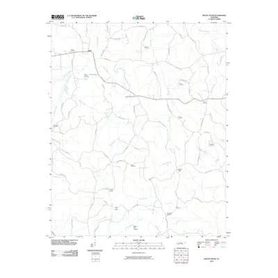
2010 Map of Mount Peter
USGS Topo · Published 2010About this map
The settlement of Finger and the surrounding rural landscapes of McNairy County are captured here during a time of modern continuity for these West Tennessee communities. The terrain is defined by a dense network of family-named landmarks and cemeteries, suggesting a deep-rooted genealogical history. Features such as Mount Carmel Cemetery, Lanes Chapel Cemetery, and Beauty Hill Cemetery are scattered throughout the landscape, providing essential touchpoints for local researchers. The hydrology of the region is equally prominent, with Sweet Lips Creek flowing in the north and the expansive Cypress Creek drainage system dominating the central and southern sections. Distinctive natural landmarks like Mount Peter and the Major Hill Hollow rise above the many branches and creeks, such as Billies Creek and Tacker Creek, which have shaped the local topography and settlement patterns over generations.
Find a feature on this map
76 named features on this map. Tap any name to fly to it.
Don’t see what you’re looking for? This feature index may not catch every label — zoom into the map to look around manually.
Map Details
Editions of this 2010 Mount Peter Map
This is the sole edition of this map. No revisions or reprints were ever made.
Other maps of this area

1936 · Leapwood
USGS Topo · 1:24,000

1936 · Enville
USGS Topo · 1:24,000

1936 · Purdy
USGS Topo · 1:24,000

1936 · Stantonville
USGS Topo · 1:24,000

1936 · Mt. Peter
USGS Topo · 1:24,000

1949 · Leapwood
USGS Topo · 1:24,000

1949 · Mt. Peter
USGS Topo · 1:24,000

1949 · Purdy
USGS Topo · 1:24,000

1949 · Stantonville
USGS Topo · 1:24,000

1950 · Enville
USGS Topo · 1:24,000