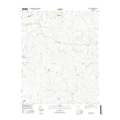
2016 Map of Mount Peter
USGS Topo · Published 2016About this map
Bethel Springs and Finger anchor the western edge of this 2016 survey, which documents a landscape of headwater creeks and ridge-top settlements in West Tennessee. The Tennessee Valley Divide snakes through the eastern half of the map, separating drainage between the Tennessee River basin and the Mississippi River watershed. This geography is defined by a high density of small rural burial grounds, including Lanes Chapel Cem, Liberty Cem, and Rose Hill Cem, which often represent the only remaining public landmarks of older agrarian communities. Named water features like Sweet Lips Cr and Hogwallow Cr flow through the dissection of the plateau, while smaller settlements like Forty Forks and Mt Peter sit at the crossroads of a complex local road network that spans the Chester and McNairy county line.
Find a feature on this map
98 named features on this map. Tap any name to fly to it.
Don’t see what you’re looking for? This feature index may not catch every label — zoom into the map to look around manually.
Map Details
Editions of this 2016 Mount Peter Map
This is the sole edition of this map. No revisions or reprints were ever made.
Other maps of this area

1936 · Leapwood
USGS Topo · 1:24,000

1936 · Enville
USGS Topo · 1:24,000

1936 · Purdy
USGS Topo · 1:24,000

1936 · Stantonville
USGS Topo · 1:24,000

1936 · Mt. Peter
USGS Topo · 1:24,000

1949 · Leapwood
USGS Topo · 1:24,000

1949 · Mt. Peter
USGS Topo · 1:24,000

1949 · Purdy
USGS Topo · 1:24,000

1949 · Stantonville
USGS Topo · 1:24,000

1950 · Enville
USGS Topo · 1:24,000