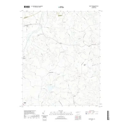
2019 Map of Mount Peter
USGS Topo · Published 2019About this map
Bethel Springs and the surrounding rural landscapes of McNairy County are defined by a network of family-named cemeteries and small watercourses. This area, situated along the Tennessee Valley Divide, features numerous small burial grounds such as Malone Cem, Jones Cem, and Lanes Chapel Cem, which offer significant value for genealogical research into the families of western Tennessee. The geography is punctuated by the intersection of small communities like Finger and Forty Forks, where the terrain transitions into the Major Hill Hollow. Water systems including Sweet Lips Cr, Billies Cr, and Tar Cr drain the undulating hills, while landmarks like Mt Peter provide focal points for the local topography. The map illustrates a rural continuity, where the road network, including Finger Leapwood Rd, still centers on these long-established settlements and family landmarks.
Find a feature on this map
61 named features on this map. Tap any name to fly to it.
Don’t see what you’re looking for? This feature index may not catch every label — zoom into the map to look around manually.
Map Details
Editions of this 2019 Mount Peter Map
This is the sole edition of this map. No revisions or reprints were ever made.
Other maps of this area

1936 · Leapwood
USGS Topo · 1:24,000

1936 · Enville
USGS Topo · 1:24,000

1936 · Purdy
USGS Topo · 1:24,000

1936 · Stantonville
USGS Topo · 1:24,000

1936 · Mt. Peter
USGS Topo · 1:24,000

1949 · Leapwood
USGS Topo · 1:24,000

1949 · Mt. Peter
USGS Topo · 1:24,000

1949 · Purdy
USGS Topo · 1:24,000

1949 · Stantonville
USGS Topo · 1:24,000

1950 · Enville
USGS Topo · 1:24,000