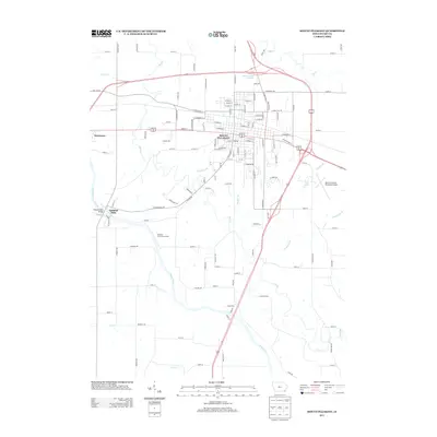
2013 Map of Mount Pleasant
USGS Topo · Published 2013About this map
Mount Pleasant serves as the central hub of this Henry County landscape, where the confluence of modern highway infrastructure and traditional river geography is clearly visible. The Skunk River winds through the southwestern portion of the sheet, anchored by the settlement of Oakland Mills and the historic Oakland Mills Bridge. The area's outdoor recreation and conservation priorities are evident in the Faulkner State Access Area and J and J Camping, providing a stark contrast to the nearby Mount Pleasant Municipal Airport and the expanding residential corridors of Westwood.
Find a feature on this map
117 named features on this map. Tap any name to fly to it.
Don’t see what you’re looking for? This feature index may not catch every label — zoom into the map to look around manually.
Map Details
Editions of this 2013 Mount Pleasant Map
This is the sole edition of this map. No revisions or reprints were ever made.
Other maps of this area

1958 · Burlington
USGS Topo · 1:250,000

1958 · Davenport
USGS Topo · 1:250,000

1961 · Burlington
USGS Topo · 1:250,000

1961 · Davenport
USGS Topo · 1:250,000

1962 · Davenport
USGS Topo · 1:250,000

1963 · Burlington
USGS Topo · 1:250,000

1980 · Trenton
USGS Topo · 1:24,000

1980 · Lockridge East
USGS Topo · 1:24,000

1981 · Mount Pleasant
USGS Topo · 1:24,000
1981 · Lowell
USGS Topo · 1:24,000