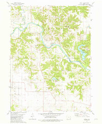
1981 Map of Lowell
USGS Topo · Published 1981About this map
The Skunk River winds through a heavily dissected landscape at the border of Henry and Lee Counties, anchoring the small settlement of Lowell. This 1981 edition captures the rural character of southeastern Iowa, where the river's high bluffs and wooded slopes contrast with the orderly grid of the surrounding agricultural townships. To the east, the map shows the recreation-focused terrain of Geode State Park and Geode Lake, while the interior contains several smaller water bodies like Lake Wilderness. For those tracing local heritage, the sheet is an excellent record of early community nodes, identifying numerous burial grounds including Clark Cem, Williamson Cem, and Friends Cem. Small rural centers are further marked by landmarks such as Bethany Ch and Pickle Ch, which stand as focal points in the townships of Baltimore and Pleasant Ridge.
Find a feature on this map
30 named features on this map. Tap any name to fly to it.
Don’t see what you’re looking for? This feature index may not catch every label — zoom into the map to look around manually.
Map Details
Editions of this 1981 Lowell Map
This is the sole edition of this map. No revisions or reprints were ever made.
Other maps of this area

1936 · Fort Madison
USGS Topo · 1:62,500

1958 · Burlington
USGS Topo · 1:250,000

1961 · Burlington
USGS Topo · 1:250,000

1963 · Burlington
USGS Topo · 1:250,000

1964 · West Point
USGS Topo · 1:24,000
1964 · Fort Madison
USGS Topo · 1:24,000

1968 · Donnellson
USGS Topo · 1:24,000

1981 · Mount Pleasant
USGS Topo · 1:24,000
1981 · Danville
USGS Topo · 1:24,000
1981 · Salem
USGS Topo · 1:24,000