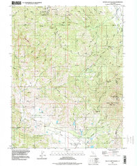
1997 Map of Mount Saint Helena
USGS Topo · Published 1998About this map
Mount Saint Helena dominates the high ground of the Mayacmas Mountains on this late 20th-century survey, a landscape defined by its geothermal activity and deep mining history. The map documents numerous historic workings such as the Chicago Mine, Helen Mine, and Wall Street Mine, tucked into the drainages of Big Sulphur Creek and Appletree Creek. These industrial sites sit in contrast to the preserved lands of the Robert Louis Stevenson State Park, which encompasses the mountain's summit and the neighboring Sacre Gap.
Find a feature on this map
75 named features on this map. Tap any name to fly to it.
Don’t see what you’re looking for? This feature index may not catch every label — zoom into the map to look around manually.
Map Details
Editions of this 1997 Mount Saint Helena Map
This is the sole edition of this map. No revisions or reprints were ever made.
Other maps of this area

1920 · Healdsburg
USGS Topo · 1:62,500

1921 · Kelseyville
USGS Topo · 1:62,500

1927 · Calistoga
USGS Topo · 1:62,500

1933 · Healdsburg
USGS Topo · 1:48,000

1940 · Healdsburg
USGS Topo · 1:62,500

1943 · Calistoga
USGS Topo · 1:62,500

1943 · Kelseyville
USGS Topo · 1:62,500

1945 · Calistoga
USGS Topo · 1:62,500

1945 · Lower Lake
USGS Topo · 1:62,500

1947 · Santa Rosa
USGS Topo · 1:250,000