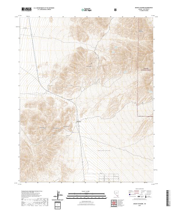
2021 Map of Mount Schader
USGS Topo · Published 2021About this map
Johnnie sits at the transition between the Johnnie Range and the northern reaches of the Pahrump Valley. This terrain is defined by the sharp elevations of Mt Schader and Mt Montgomery, which give way to the expansive Mineral Flat and the edges of the Mojave Desert. The map reveals a landscape where water is the primary arbiter of geography, marked by isolated points like Diebert Spring, Kwichup Spring, and Horseshutem Springs. To the northeast, the topography climbs toward the Spring Mountains and the boundary of the Toiyabe National Forest. Transportation is limited to a few arterial routes like Crystal Rd and Ohio Rd, alongside the evocative Butch Cassidy Pass, illustrating the sparse, high-desert character of Nye County.
Find a feature on this map
22 named features on this map. Tap any name to fly to it.
Don’t see what you’re looking for? This feature index may not catch every label — zoom into the map to look around manually.
Map Details
Editions of this 2021 Mount Schader Map
This is the sole edition of this map. No revisions or reprints were ever made.
Other maps of this area

1907 · Las Vegas
USGS Topo · 1:250,000

1908 · Furnace Creek
USGS Topo · 1:250,000

1908 · Las Vegas
USGS Topo · 1:250,000

1910 · Furnace Creek
USGS Topo · 1:250,000

1942 · Indian Spring
USGS Topo · 1:125,000

1942 · Skull Mountain
USGS Topo · 1:125,000

1948 · Death Valley
USGS Topo · 1:250,000

1952 · Specter Range
USGS Topo · 1:62,500

1952 · Mercury
USGS Topo · 1:62,500

1954 · Las Vegas
USGS Topo · 1:250,000