
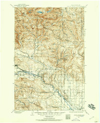
1897 Map of Mount Stuart
USGS Topo · Published 1897About this map
Ellensburg serves as the focal point of the southern Kittitas Valley in this late 19th-century survey, just as the regional economy was being shaped by the arrival of the Northern Pacific railroad. To the west, the coal mining influence is evident in the layout of Roslyn and Cle Elum, where the P. R. R. (Roslyn Branch) connects the mining district to the main rail line. The map illustrates a sharp transition from the irrigated agricultural flats of the valley into the high timber and mining camps of the Wenatchee Mountains.
Find a feature on this map
105 named features on this map. Tap any name to fly to it.
Don’t see what you’re looking for? This feature index may not catch every label — zoom into the map to look around manually.
Map Details
Editions of this 1897 Mount Stuart Map
2 editions found
Other maps of this area

1899 · Ellensburg
USGS Topo · 1:125,000

1901 · Chelan
USGS Topo · 1:125,000

1901 · Ellensburg
USGS Topo · 1:125,000

1901 · Chiwaukum
USGS Topo · 1:125,000

1901 · Snoqualmie Pass
USGS Topo · 1:125,000

1902 · Mount Aix
USGS Topo · 1:125,000

1902 · Skykomish
USGS Topo · 1:125,000

1902 · Mount Stuart
USGS Topo · 1:125,000

1903 · Snoqualmie
USGS Topo · 1:125,000

1904 · Mt Aix
USGS Topo · 1:125,000