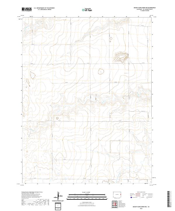
2022 Map of Mount Sunflower NW
USGS Topo · Published 2022About this map
The N Fork Smoky Hill River carves through the southeastern corner of this landscape, marking a significant drainage point for the high plains of eastern Colorado. This remote section of Kit Carson County is defined by its wide, open section lines and a sparse network of county roads like Co Rd N and Co RD 53 that track the rectangular survey system. The hydrology is dominated by ephemeral watercourses, including the winding path of Sandy Cr and the northern reaches of Middle Beaver Cr. The map illustrates a strictly rural environment where land use is dictated by the township and range system, seen in the clear divisions of t9s r43w and t10s r42w. The placement of roads often follows the contours of the minor valleys, reflecting how the local terrain influences human passage across the prairie.
Find a feature on this map
24 named features on this map. Tap any name to fly to it.
Don’t see what you’re looking for? This feature index may not catch every label — zoom into the map to look around manually.
Map Details
Editions of this 2022 Mount Sunflower NW Map
This is the sole edition of this map. No revisions or reprints were ever made.
Other maps of this area

1954 · Limon
USGS Topo · 1:250,000

1957 · Limon
USGS Topo · 1:250,000

1958 · Limon
USGS Topo · 1:250,000

1969 · Mount Sunflower SW
USGS Topo · 1:24,000

1969 · Burlington 3 SE
USGS Topo · 1:24,000
1969 · Mount Sunflower
USGS Topo · 1:24,000

1969 · Burlington
USGS Topo · 1:24,000

1969 · Mount Sunflower NW
USGS Topo · 1:24,000
1969 · Mount Sunflower NE
USGS Topo · 1:24,000

1969 · Peconic
USGS Topo · 1:24,000