
1969 Map of Mount Sunflower NW
USGS Topo · Published 1972About this map
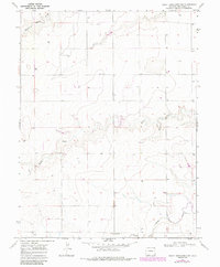
Smoky Hill Sch stands as a focal point in this 1969 topographic portrait of Kit Carson County, providing a glimpse into the rural educational infrastructure of the High Plains. The landscape is defined by the subtle drainage patterns of Middle Beaver Creek and Sandy Creek, which etch their way across the terrain toward the North Fork Smoky Hill River at the southern edge of the sheet. The sparse settlement pattern, including the named location of Janssen, reflects the area's agricultural character during the late 1960s. Numerous individual wells are documented across the grid, indicating the vital importance of groundwater management for the ranching and farming operations that sustain this part of eastern Colorado. This survey, based on 1968 aerial photography, offers a detailed record of land use and water resources prior to modern pivots and large-scale agricultural developments.
Find a feature on this map
6 named features on this map. Tap any name to fly to it.
Don’t see what you’re looking for? This feature index may not catch every label — zoom into the map to look around manually.
Map Details
Editions of this 1969 Mount Sunflower NW Map
2 editions found
Other maps of this area

1954 · Limon
USGS Topo · 1:250,000

1957 · Limon
USGS Topo · 1:250,000

1958 · Limon
USGS Topo · 1:250,000

1969 · Mount Sunflower SW
USGS Topo · 1:24,000

1969 · Burlington 3 SE
USGS Topo · 1:24,000
1969 · Mount Sunflower
USGS Topo · 1:24,000

1969 · Burlington
USGS Topo · 1:24,000
1969 · Mount Sunflower NE
USGS Topo · 1:24,000

1969 · Peconic
USGS Topo · 1:24,000
1969 · Kanorado
USGS Topo · 1:24,000