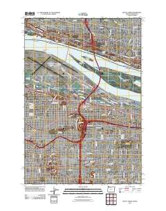
2011 Map of Mount Tabor
USGS Topo · Published 2011About this map
The Columbia River corridor defines the northern edge of this 2011 survey, separating Portland from Vancouver. The landscape is dominated by the sprawling infrastructure of the Portland International Airport and the surrounding industrial and residential neighborhoods of Parkrose and Maywood Park. The map provides a detailed view of the urban grid, including several large green spaces such as the Rose City Golf Course and Glendoveer Golf Course.
Find a feature on this map
91 named features on this map. Tap any name to fly to it.
Don’t see what you’re looking for? This feature index may not catch every label — zoom into the map to look around manually.
Map Details
Editions of this 2011 Mount Tabor Map
This is the sole edition of this map. No revisions or reprints were ever made.
Other maps of this area

1897 · Portland
USGS Topo · 1:62,500

1905 · Portland
USGS Topo · 1:62,500

1911 · Boring
USGS Topo · 1:48,000

1914 · Boring
USGS Topo · 1:62,500

1914 · Oregon City
USGS Topo · 1:62,500

1916 · Estacada
USGS Topo · 1:125,000

1918 · Troutdale
USGS Topo · 1:62,500

1934 · Troutdale
USGS Topo · 1:48,000

1939 · Oregon City
USGS Topo · 1:62,500

1940 · Boring
USGS Topo · 1:62,500