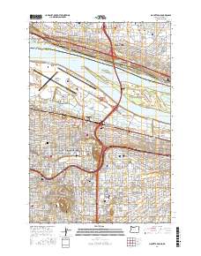
2017 Map of Mount Tabor
USGS Topo · Published 2017About this map
Mt Tabor and the surrounding neighborhoods of East Portland and Vancouver define this 2017 landscape, split by the massive flow of the Columbia River. The map meticulously details the urban transformation of the area, showing the established residential grids of Laurelhurst, Montavilla, and Hollywood as they interface with major transit corridors like NE Sandy Blvd. Local history and genealogy are anchored by several prominent burial grounds, including the Fisher Cem and Columbia Masonic Cem. The river's character is evidenced by a complex system of islands and bars, such as Government Island and Lemon Island, which sit between the bustling Portland International Airport and the Washington shoreline. This survey captures a modern metropolitan environment still shaped by its prominent volcanic buttes, with Rocky Butte standing as a significant landmark overlooking the Columbia Slough.
Find a feature on this map
60 named features on this map. Tap any name to fly to it.
Don’t see what you’re looking for? This feature index may not catch every label — zoom into the map to look around manually.
Map Details
Editions of this 2017 Mount Tabor Map
This is the sole edition of this map. No revisions or reprints were ever made.
Other maps of this area

1897 · Portland
USGS Topo · 1:62,500

1905 · Portland
USGS Topo · 1:62,500

1911 · Boring
USGS Topo · 1:48,000

1914 · Boring
USGS Topo · 1:62,500

1914 · Oregon City
USGS Topo · 1:62,500

1916 · Estacada
USGS Topo · 1:125,000

1918 · Troutdale
USGS Topo · 1:62,500

1934 · Troutdale
USGS Topo · 1:48,000

1939 · Oregon City
USGS Topo · 1:62,500

1940 · Boring
USGS Topo · 1:62,500