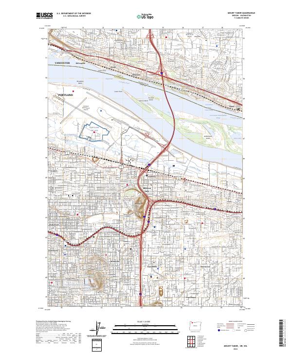
2024 Map of Mount Tabor
USGS Topo · Published 2024About this map
Mt Tabor and the cinder cone of Rocky Butte rise above the residential grid of East Portland and across the Columbia River into Vancouver. This 2024 survey captures the densely settled neighborhoods of Parkrose, Montavilla, and Powellhurst, framed by the massive footprint of the Portland International Airport. The map highlights a significant concentration of local heritage sites, including the Japanese Cem, Columbia Pioneer Cem, and Rose City Cem. Along the river, the Government Island Game Management Area stands as a large natural break in the urban sprawl. Educational institutions such as Multnomah University and the Linfield University Portland Campus are central landmarks, while the City of Portland Reservoir Number 1 and its neighbors reflect the critical infrastructure of the Willamette Valley's largest city.
Find a feature on this map
55 named features on this map. Tap any name to fly to it.
Don’t see what you’re looking for? This feature index may not catch every label — zoom into the map to look around manually.
Map Details
Editions of this 2024 Mount Tabor Map
This is the sole edition of this map. No revisions or reprints were ever made.
Other maps of this area

1897 · Portland
USGS Topo · 1:62,500

1905 · Portland
USGS Topo · 1:62,500

1911 · Boring
USGS Topo · 1:48,000

1914 · Boring
USGS Topo · 1:62,500

1914 · Oregon City
USGS Topo · 1:62,500

1916 · Estacada
USGS Topo · 1:125,000

1918 · Troutdale
USGS Topo · 1:62,500

1934 · Troutdale
USGS Topo · 1:48,000

1939 · Oregon City
USGS Topo · 1:62,500

1940 · Boring
USGS Topo · 1:62,500