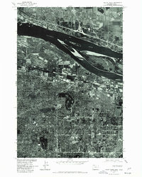
1975 Map of Mount Tabor
USGS Topo · Published 1977About this map
The Columbia River serves as a stark dividing line between Washington and Oregon in this mid-1970s orthophotoquad. This unique perspective, produced by the Geological Survey in cooperation with the U. S. Corps of Engineers, utilizes aerial imagery from 1975 to provide a literal view of the landscape rather than a traditional line-drawn map. The densely developed residential grids of Portland extend south toward the volcanic cinder cone of Mount Tabor, while the north shore shows the growth of Vancouver. The expansive footprint of Portland International Airport dominates the Oregon riverfront, illustrating the critical role of the river corridor in the region's transportation and aviation infrastructure during this period of Pacific Northwest urban expansion.
Find a feature on this map
5 named features on this map. Tap any name to fly to it.
Don’t see what you’re looking for? This feature index may not catch every label — zoom into the map to look around manually.
Map Details
Editions of this 1975 Mount Tabor Map
This is the sole edition of this map. No revisions or reprints were ever made.
Other maps of this area

1897 · Portland
USGS Topo · 1:62,500

1905 · Portland
USGS Topo · 1:62,500

1911 · Boring
USGS Topo · 1:48,000

1914 · Boring
USGS Topo · 1:62,500

1914 · Oregon City
USGS Topo · 1:62,500

1916 · Estacada
USGS Topo · 1:125,000

1918 · Troutdale
USGS Topo · 1:62,500

1934 · Troutdale
USGS Topo · 1:48,000

1939 · Oregon City
USGS Topo · 1:62,500

1940 · Boring
USGS Topo · 1:62,500