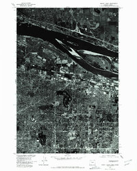
1976 Map of Mount Tabor
USGS Topo · Published 1981About this map
Mount Tabor rises as a prominent landmark in this 1970s orthophotographic study, which utilizes aerial imagery taken by the U. S. Corps of Engineers to reveal the dense urban fabric of eastern Portland. Unlike traditional topographic maps that rely on contour lines and symbols, this aerial perspective captures the literal footprint of mid-century residential growth, commercial corridors, and the sprawling industrial activity along the riverfront. The imagery provides a clear view of the parklands surrounding the cinder cone at Mount Tabor, contrasting the preserved natural space with the surrounding street grid that defines this portion of Multnomah County. Researchers can observe the exact configuration of infrastructure and housing as it existed in September 1975, offering a precise visual record of the city's suburban and industrial evolution during this era.
Find a feature on this map
2 named features on this map. Tap any name to fly to it.
Don’t see what you’re looking for? This feature index may not catch every label — zoom into the map to look around manually.
Map Details
Editions of this 1976 Mount Tabor Map
This is the sole edition of this map. No revisions or reprints were ever made.
Other maps of this area

1897 · Portland
USGS Topo · 1:62,500

1905 · Portland
USGS Topo · 1:62,500

1911 · Boring
USGS Topo · 1:48,000

1914 · Boring
USGS Topo · 1:62,500

1914 · Oregon City
USGS Topo · 1:62,500

1916 · Estacada
USGS Topo · 1:125,000

1918 · Troutdale
USGS Topo · 1:62,500

1934 · Troutdale
USGS Topo · 1:48,000

1939 · Oregon City
USGS Topo · 1:62,500

1940 · Boring
USGS Topo · 1:62,500