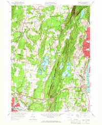
1958 Map of Mount Tom
USGS Topo · Published 1966About this map
Mount Tom Range dominates this mid-century landscape, a prominent ridge separating the urbanized corridor of the Connecticut River from the agricultural and suburbanizing reaches of Southampton and Westfield. The map reveals the post-war industrial and transportation infrastructure of Western Massachusetts, notably featuring the Massachusetts Turnpike and the Barnes Municipal Airport. The eastern side of the ridge shows the dense neighborhood development of Holyoke and West Springfield, where residential areas like Oakdale and Elmwood are packed with schools and churches, including the Dominican Monastery and Blessed Sacrament Sch. Significant water resources are managed across the terrain, from the Whiting Street Reservoir perched on the mountain's shoulder to the Ashley Pond system. Local industry is marked by several Sand and Gravel Pits and the proximity of the New York Central Railroad, reflecting a period of active regional growth.
Find a feature on this map
126 named features on this map. Tap any name to fly to it.
Don’t see what you’re looking for? This feature index may not catch every label — zoom into the map to look around manually.
Map Details
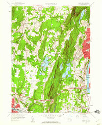
Editions of this 1958 Mount Tom Map
2 editions found
Other maps of this area

1885 · Northampton
USGS Topo · 1:62,500

1886 · Springfield
USGS Topo · 1:62,500

1886 · Chesterfield
USGS Topo · 1:62,500

1886 · Northampton
USGS Topo · 1:62,500

1887 · Granville
USGS Topo · 1:62,500

1888 · Chesterfield
USGS Topo · 1:62,500

1889 · Springfield
USGS Topo · 1:62,500

1889 · Granville
USGS Topo · 1:62,500

1891 · Northampton
USGS Topo · 1:62,500

1893 · Northampton
USGS Topo · 1:62,500