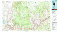
1986 Map of Mount Trumbull
USGS Topo · Published 1987About this map
Grand Canyon National Park and the expansive Lake Mead National Recreation Area dominate this mid-1980s landscape of the Arizona Strip. The high tablelands of the Shivwits Plateau and Uinkaret Plateau are defined by dramatic vertical relief, dropping away at the Grand Wash Cliffs and the deep incision of the Lower Granite Gorge. This era of the map shows a landscape shaped by both geology and isolated human industry, marked by remote mining operations such as the Savannic Mine and the Grand Gulch Mine in the western reaches.
Find a feature on this map
98 named features on this map. Tap any name to fly to it.
Don’t see what you’re looking for? This feature index may not catch every label — zoom into the map to look around manually.
Map Details
Editions of this 1986 Mount Trumbull Map
2 editions found
Other maps of this area

1886 · Diamond Creek
USGS Topo · 1:250,000

1886 · Camp Mohave
USGS Topo · 1:250,000

1886 · Saint Thomas
USGS Topo · 1:250,000

1886 · Mt. Trumbull
USGS Topo · 1:250,000

1886 · Chino
USGS Topo · 1:250,000

1886 · Kaibab
USGS Topo · 1:250,000

1891 · Chino
USGS Topo · 1:250,000

1892 · Diamond Creek
USGS Topo · 1:250,000

1892 · Mt. Trumbull
USGS Topo · 1:250,000

1892 · Camp Mohave
USGS Topo · 1:250,000