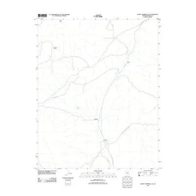
2011 Map of Mount Trumbull NE
USGS Topo · Published 2011About this map
The settlement of Tuweep serves as a focal point in this high-desert landscape, situated on the approach to the northern reaches of Grand Canyon National Park. The topography is dominated by the sprawling Uinkaret Plateau and the descent into Broad Canyon, where the scarcity of water is evidenced by the mapping of specific catchments and man-made improvements. Features such as Little Toroweap Reservoir, Witch Pool, and John Schmutz Tank indicate the vital infrastructure required for ranching and survival in this arid environment. Transportation through the region relies on established routes like Mount Trumbull Rd and Craig Ranch Rd, which connect isolated outposts like Graham Ranch to the broader Arizona wilderness. This map provides a clear picture of the intersection between federal park lands and the working ranching landscape of Mohave County.
Find a feature on this map
14 named features on this map. Tap any name to fly to it.
Don’t see what you’re looking for? This feature index may not catch every label — zoom into the map to look around manually.
Map Details
Editions of this 2011 Mount Trumbull NE Map
This is the sole edition of this map. No revisions or reprints were ever made.
Other maps of this area

1886 · Mt. Trumbull
USGS Topo · 1:250,000

1886 · Kaibab
USGS Topo · 1:250,000

1892 · Mt. Trumbull
USGS Topo · 1:250,000

1953 · Grand Canyon
USGS Topo · 1:250,000

1954 · Heaton Knolls
USGS Topo · 1:62,500

1957 · Grand Canyon
USGS Topo · 1:250,000

1958 · Grand Canyon
USGS Topo · 1:250,000

1960 · Grand Canyon
USGS Topo · 1:250,000

1962 · Tuckup Canyon
USGS Topo · 1:62,500
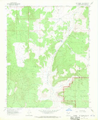
1967 · Mt. Trumbull NE
USGS Topo · 1:24,000