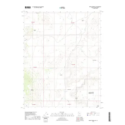
2018 Map of Mount Trumbull NE
USGS Topo · Published 2018About this map
Tuweep stands as a focal point in this high-desert landscape of the Arizona Strip, positioned where the geological transitions between massive plateaus define the terrain. The map illustrates the convergence of the Uinkaret Plateau and the Kanab Plateau, with the Uinkaret Mountains rising to the southwest. This area is characterized by significant vertical relief, most notably the Toroweap Cliffs and the northern reaches of Grand Canyon National Park. Water management is critical in this arid environment, evidenced by isolated features like Little Toroweap Reservoir, Witch Pool, and the John Schmutz Tank. These sparse water sources and the network of unpaved routes such as Co RD 5 provide a window into the cattle ranching and homesteading history of Mohave County, where life followed the contours of the Toroweap Valley and the drainage of Broad Canyon.
Find a feature on this map
23 named features on this map. Tap any name to fly to it.
Don’t see what you’re looking for? This feature index may not catch every label — zoom into the map to look around manually.
Map Details
Editions of this 2018 Mount Trumbull NE Map
This is the sole edition of this map. No revisions or reprints were ever made.
Other maps of this area

1886 · Mt. Trumbull
USGS Topo · 1:250,000

1886 · Kaibab
USGS Topo · 1:250,000

1892 · Mt. Trumbull
USGS Topo · 1:250,000

1953 · Grand Canyon
USGS Topo · 1:250,000

1954 · Heaton Knolls
USGS Topo · 1:62,500

1957 · Grand Canyon
USGS Topo · 1:250,000

1958 · Grand Canyon
USGS Topo · 1:250,000

1960 · Grand Canyon
USGS Topo · 1:250,000

1962 · Tuckup Canyon
USGS Topo · 1:62,500
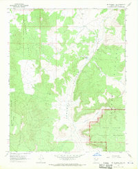
1967 · Mt. Trumbull NE
USGS Topo · 1:24,000