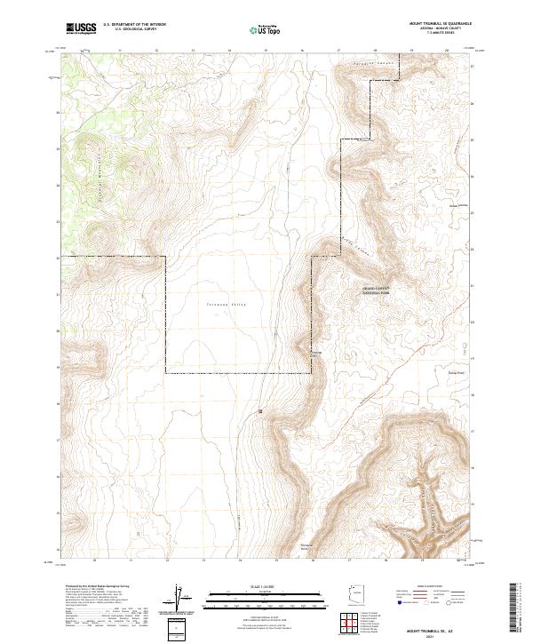
2021 Map of Mount Trumbull SE
USGS Topo · Published 2021About this map
Grand Canyon National Park occupies the eastern half of this sheet, where the high desert terrain of the Kanab Plateau meets a dramatic series of descent points into the canyon system. The landscape is defined by massive geological shifts, from the heights of the Uinkaret Mountains in the west to the broad expanse of Toroweap Valley. A complex network of drainage and erosion is visible through named features such as Paradise Canyon, Cunninghams Canyon, and Brady Canyon, which cut through the plateau towards the rim.
Find a feature on this map
22 named features on this map. Tap any name to fly to it.
Don’t see what you’re looking for? This feature index may not catch every label — zoom into the map to look around manually.
Map Details
Editions of this 2021 Mount Trumbull SE Map
This is the sole edition of this map. No revisions or reprints were ever made.
Other maps of this area

1886 · Mt. Trumbull
USGS Topo · 1:250,000

1886 · Kaibab
USGS Topo · 1:250,000

1892 · Mt. Trumbull
USGS Topo · 1:250,000

1953 · Grand Canyon
USGS Topo · 1:250,000

1957 · Grand Canyon
USGS Topo · 1:250,000

1958 · Grand Canyon
USGS Topo · 1:250,000

1960 · Grand Canyon
USGS Topo · 1:250,000

1962 · Tuckup Canyon
USGS Topo · 1:62,500

1962 · National Canyon
USGS Topo · 1:62,500
1967 · Mt. Trumbull NE
USGS Topo · 1:24,000