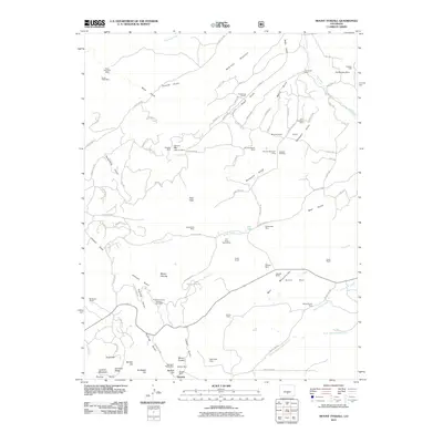
2011 Map of Mount Tyndall
USGS Topo · Published 2011About this map
Mining operations and cattle ranching define the rugged character of the Wet Mountains in this modern-era study of Custer County. The landscape is heavily marked by a legacy of extraction, concentrated particularly around the settlement of Querida and the Rosita Hills. Here, the prominent Bassick Mine and Big Stake Nickel Mine stand near the base of Mount Tyndall, signaling a complex history of sub-surface exploration that extends north toward McKinley Mountain.
Find a feature on this map
104 named features on this map. Tap any name to fly to it.
Don’t see what you’re looking for? This feature index may not catch every label — zoom into the map to look around manually.
Map Details
Editions of this 2011 Mount Tyndall Map
This is the sole edition of this map. No revisions or reprints were ever made.
Other maps of this area

1889 · Canon City
USGS Topo · 1:125,000

1892 · Canon City
USGS Topo · 1:125,000

1954 · Mount Tyndall
USGS Topo · 1:24,000

1954 · Rosita
USGS Topo · 1:24,000

1954 · Pueblo
USGS Topo · 1:250,000

1955 · Westcliffe
USGS Topo · 1:24,000

1957 · Pueblo
USGS Topo · 1:250,000

1957 · Aldrich Gulch
USGS Topo · 1:24,000

1958 · Pueblo
USGS Topo · 1:250,000

1959 · Rockvale
USGS Topo · 1:24,000