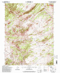
1994 Map of Mount Tyndall
USGS Topo · Published 1998About this map
Querida and the surrounding mining district anchor the southern landscape of this mid-1990s survey. The area's legacy of silver extraction is evident in numerous prospects and mines dotting Bassick Hill and Bunker Hill. To the north, the land transitions into the high-elevation pastures and drainages of the San Isabel National Forest, where a network of family-run operations like Armstrong Ranch and Kness Ranch defines the rural character of the Wet Mountains.
Find a feature on this map
40 named features on this map. Tap any name to fly to it.
Don’t see what you’re looking for? This feature index may not catch every label — zoom into the map to look around manually.
Map Details
Editions of this 1994 Mount Tyndall Map
This is the sole edition of this map. No revisions or reprints were ever made.
Other maps of this area

1889 · Canon City
USGS Topo · 1:125,000

1892 · Canon City
USGS Topo · 1:125,000

1954 · Mount Tyndall
USGS Topo · 1:24,000

1954 · Rosita
USGS Topo · 1:24,000

1954 · Pueblo
USGS Topo · 1:250,000

1955 · Westcliffe
USGS Topo · 1:24,000

1957 · Pueblo
USGS Topo · 1:250,000

1957 · Aldrich Gulch
USGS Topo · 1:24,000

1958 · Pueblo
USGS Topo · 1:250,000

1959 · Rockvale
USGS Topo · 1:24,000