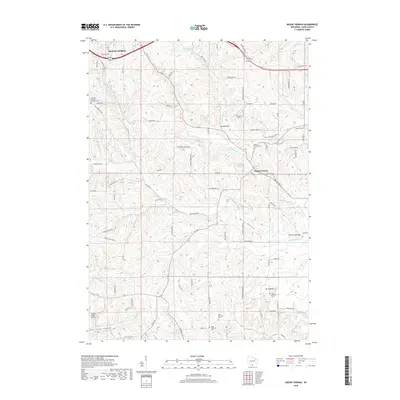
2018 Map of Mount Vernon
USGS Topo · Published 2018About this map
Mount Vernon sits as a central hub in this corner of Dane County, where the valley of the Mount Vernon Cr meets the larger drainage of the W Br Sugar River. This landscape is defined by its deep cultural and genealogical roots, evidenced by numerous local burial grounds such as the East Primrose Cem, West Primrose Cem, and East Blue Mounds Lutheran Cem. The terrain is marked by distinctive geological features like Donald Rock and Devils Chimney, alongside the broad stretches of Britt Valley and Kittleson Valley. To the northwest, the edge of Mount Horeb appears, while the southern reaches are punctuated by the rural community of Mt Pleasant and its associated Mount Pleasant Cem. Transportation and commerce are represented by the small Cardinal Ridge Airport and a dense network of county roads like Co RD J and Co RD G.
Find a feature on this map
85 named features on this map. Tap any name to fly to it.
Don’t see what you’re looking for? This feature index may not catch every label — zoom into the map to look around manually.
Map Details
Editions of this 2018 Mount Vernon Map
This is the sole edition of this map. No revisions or reprints were ever made.
Other maps of this area

1907 · Cross Plains
USGS Topo · 1:62,500

1909 · Cross Plains
USGS Topo · 1:62,500

1920 · Blue Mounds
USGS Topo · 1:62,500

1922 · Blue Mounds
USGS Topo · 1:62,500

1923 · Blanchardville
USGS Topo · 1:62,500

1923 · New Glarus
USGS Topo · 1:62,500

1954 · Rockford
USGS Topo · 1:250,000

1955 · Rockford
USGS Topo · 1:250,000

1957 · Madison
USGS Topo · 1:250,000

1958 · Rockford
USGS Topo · 1:250,000