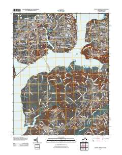
2011 Map of Mount Vernon
USGS Topo · Published 2011About this map
Mount Vernon and the surrounding Potomac River shoreline appear in this detailed survey, documenting the dense suburban development of northern Virginia and southern Maryland. The map illustrates the historic transition from the ancestral estate at Mount Vernon Wharf to modern residential enclaves like Stratford Landing and Hybla Valley. Across the river, Fort Washington and its eponymous Fort Washington National Park anchor the Maryland side, preserved amidst the growth of communities like Tantallon.
Find a feature on this map
198 named features on this map. Tap any name to fly to it.
Don’t see what you’re looking for? This feature index may not catch every label — zoom into the map to look around manually.
Map Details
Editions of this 2011 Mount Vernon Map
This is the sole edition of this map. No revisions or reprints were ever made.
Other maps of this area

1890 · Mt. Vernon
USGS Topo · 1:125,000

1891 · Mt. Vernon
USGS Topo · 1:125,000

1892 · Brandywine
USGS Topo · 1:62,500

1894 · Mt. Vernon
USGS Topo · 1:125,000

1895 · Brandywine
USGS Topo · 1:62,500

1897 · Mt. Vernon
USGS Topo · 1:125,000

1899 · Patuxent
USGS Topo · 1:125,000

1900 · Washington
USGS Topo · 1:62,500
1906 · Patuxent
USGS Topo · 1:125,000
1911 · Brandywine
USGS Topo · 1:62,500