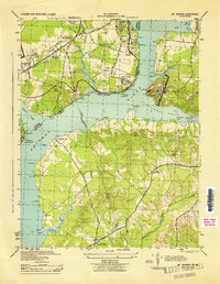
1944 Map of Mount Vernon
USGS Topo · Published 1944About this map
Fort Washington and Fort Hunt stand guard on opposite banks of the Potomac River in this 1944 War Department survey, marking a landscape defined by military history and the expansion of the capital's suburban and recreational reach. The map captures the Virginia shoreline as it transitioned from rural estates to more structured developments, with the Mount Vernon Memorial Highway and Jefferson Davis Highway providing critical transportation arteries. Notable landmarks like the Hybla Valley Airport and the U S Bureau of Fisheries installation reflect the era's specialized land use near the water.
Find a feature on this map
50 named features on this map. Tap any name to fly to it.
Don’t see what you’re looking for? This feature index may not catch every label — zoom into the map to look around manually.
Map Details
Editions of this 1944 Mount Vernon Map
This is the sole edition of this map. No revisions or reprints were ever made.
Other maps of this area

1890 · Mt. Vernon
USGS Topo · 1:125,000

1891 · Mt. Vernon
USGS Topo · 1:125,000

1892 · Brandywine
USGS Topo · 1:62,500

1894 · Mt. Vernon
USGS Topo · 1:125,000

1895 · Brandywine
USGS Topo · 1:62,500

1897 · Mt. Vernon
USGS Topo · 1:125,000

1899 · Patuxent
USGS Topo · 1:125,000

1900 · Washington
USGS Topo · 1:62,500

1906 · Patuxent
USGS Topo · 1:125,000

1911 · Brandywine
USGS Topo · 1:62,500