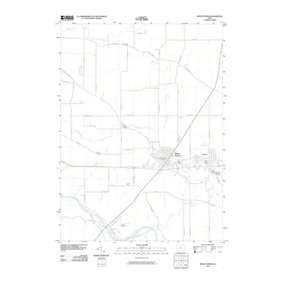
2010 Map of Mount Vernon
USGS Topo · Published 2010About this map
The Mount Vernon and Lisbon communities anchor this Linn County landscape, shown here at a moment of continued growth and development. Located near the southern edge of the quadrangle, these settlements are defined by a structured grid of streets, including N Washington ST and 1st ST W, while rural life continues in the surrounding hills. The Cedar River flows through the southwestern corner near Ivanhoe, where the terrain transitions from cultivated fields to riverbank. Local history is deeply etched into the land through numerous burial grounds, such as Mount Zion Cemetery in the north and Saint John Catholic Cemetery to the southeast. The map also traces the drainage patterns of Abbe Creek and Elbow Creek, illustrating how the natural topography influenced early roads like Linn Ridge RD and Abbe Hills RD. This survey captures the enduring presence of local institutions like Saint Mary church and the essential Mount Vernon Post Office.
Find a feature on this map
54 named features on this map. Tap any name to fly to it.
Don’t see what you’re looking for? This feature index may not catch every label — zoom into the map to look around manually.
Map Details
Editions of this 2010 Mount Vernon Map
This is the sole edition of this map. No revisions or reprints were ever made.
Other maps of this area

1887 · Cedar Rapids
USGS Topo · 1:62,500

1888 · Marion
USGS Topo · 1:62,500

1889 · Marion
USGS Topo · 1:62,500

1890 · Anamosa
USGS Topo · 1:62,500

1891 · Mechanicsville
USGS Topo · 1:62,500

1891 · Cedar Rapids
USGS Topo · 1:62,500

1894 · Mechanicsville
USGS Topo · 1:62,500

1900 · Anamosa
USGS Topo · 1:125,000

1901 · Stanwood
USGS Topo · 1:125,000

1903 · Fairfax
USGS Topo · 1:125,000