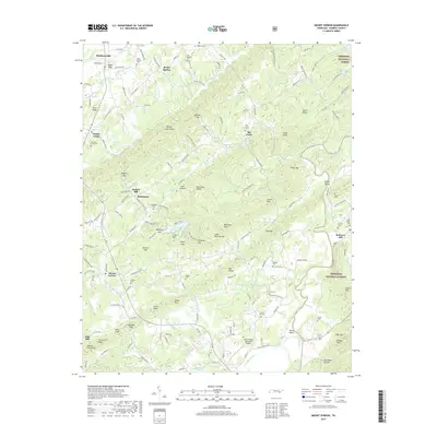
2019 Map of Mount Vernon
USGS Topo · Published 2019About this map
Madisonville and the surrounding Monroe County landscape are defined by the winding course of the Tellico River and the eastern edge of the Cherokee National Forest. This 2019 survey captures a rural terrain marked by family-named landmarks and historical community centers like Rocky Spring, Notchy Creek, and Bethlehem. The topography is dominated by local heights such as Notchy Creek Knobs and Moses Mtn, while the valley floors are dotted with numerous burial grounds, including the Old Prospect Cem and Webb Cem. The map reveals the area's agricultural and industrial legacy through the presence of old milling sites like Stakely Mill and Belltown Mill situated along the creeks. Transportation patterns are anchored by the L & N RR corridor and the Tellico Plains Municipal Airport, illustrating how local connectivity evolved alongside the natural ridges and gaps, such as Bogard Gap and Isbell Gap, which have long dictated travel through these hills.
Find a feature on this map
184 named features on this map. Tap any name to fly to it.
Don’t see what you’re looking for? This feature index may not catch every label — zoom into the map to look around manually.
Map Details
Editions of this 2019 Mount Vernon Map
This is the sole edition of this map. No revisions or reprints were ever made.
Other maps of this area

1893 · Murphy
USGS Topo · 1:125,000

1895 · Loudon
USGS Topo · 1:125,000

1914 · Murphy
USGS Topo · 1:125,000

1933 · Haw Knob
USGS Topo · 1:48,000

1933 · Bald River Falls
USGS Topo · 1:24,000

1933 · Rafter
USGS Topo · 1:24,000

1934 · Mount Vernon
USGS Topo · 1:24,000

1934 · Mecca
USGS Topo · 1:24,000

1934 · Englewood
USGS Topo · 1:24,000

1934 · Tellico Plains
USGS Topo · 1:24,000